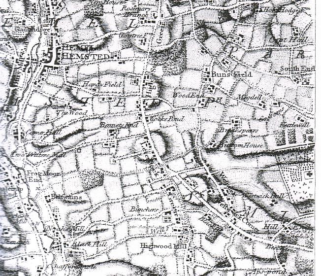
An extract from the 1766 publication
"A Topographical Map of Hartfordshire
from an Actual Survey" by Dury & Andrews.
This facsimile published by Hertfordshire Publications.
Despite being surveyed, the map is not 100% accurate, though it gives an excellent idea of both the settlement, land use, and topography of the area. It can be seen clearly from this map that the settlement along Westwick Row and Leverstock Green were totally separate, but not insubstantial, from that at Hemel Hempstead. The parish boundaries (...........................)are also clearly visible.
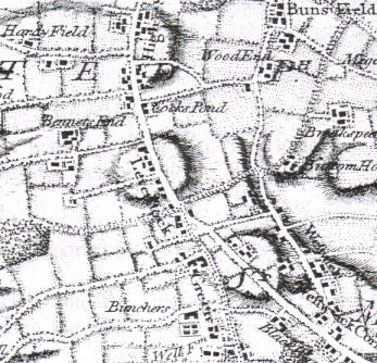
The enlargement below shows just the area immediately around Leverstock Green.